By Eilene Lyon
What eventually became the Great Allegheny Passage (GAP) rail trail was conceived in the 1970s. The trail partly replaces the route of the Western Maryland Railroad. The entire 149-mile distance between Pittsburg, Penn. and Cumberland, Md. was not completed until 2013. In conjunction with the C & O Canal towpath (a National Park), cyclists can now ride a contiguous 330-mile, mostly gravel path to Washington, D.C.
We hired Maple Leaf Outfitters to build an itinerary, recommend lodging, and to schlep our luggage from town to town. I planned our trip back in April, since September is a popular time to ride the trails. Lodging in the small towns along the way is limited and some places were already full. Having ebikes expanded our options a bit, because leaving the trail meant climbing substantial hills.
Sept. 10:
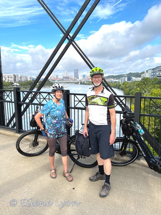
As we rode through the outskirts of Pittsburgh, we could see remnants of bygone industrial eras. There are some signs along the way with historic photos and stories. Other times, we simply observed the derelict buildings. At about Mile 132 (counting down), we left the Monongahela River and began following the Youghiogheny (Yok-a-GAY-nee) River.


There were two couples from Washington State who started the ride the same time as we did. One of the women likes to ask people she meets “do you know…[person in your city]?” Usually she hears “No.” She was thrilled when I said, “Why yes, actually I DO know Lori S. in Durango”
We leap-frogged with them and shared a shuttle ride around a 2-mile section of trail that is closed for construction. We saw them again at our second-night stop. Throughout our trip we had multiple encounters with other riders along the way.
Sept. 11:
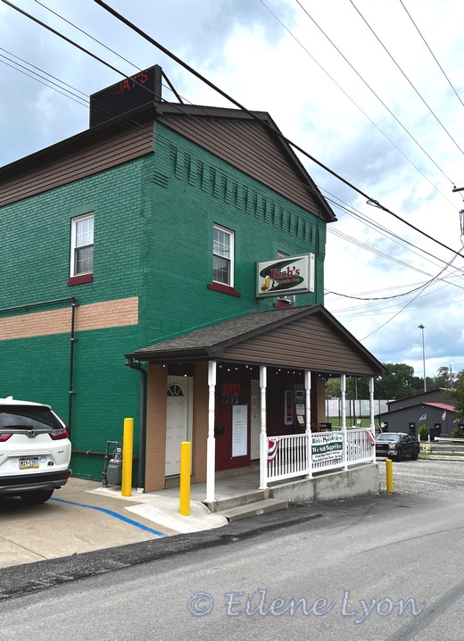
From my trip journal: “Yeah, yeah, it’s the 25th anniversary of 9/11/01. That will not fix anything that’s wrong with this country. But, Ohiopyle (pop. 59) is what’s right—for the smallest, busiest tourist town (probably) in the U.S. What a delightful and progressive place! Day 2 on the GAP has been spectacular. Our crotches are sore, our tummies are full.”


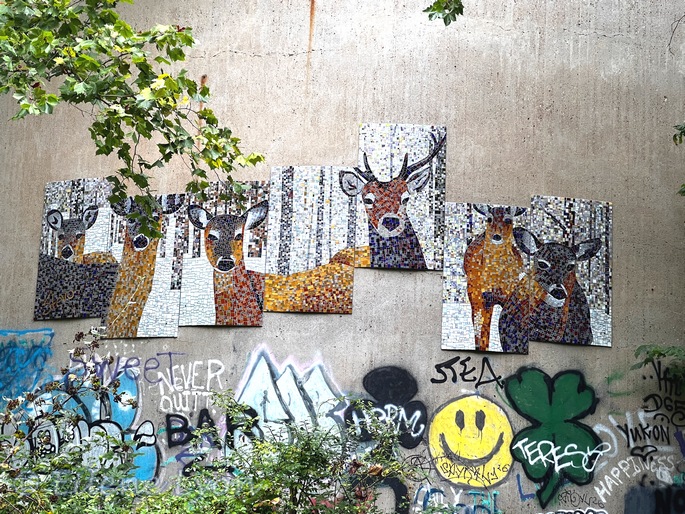
We began our day near Smithton (hometown of Shirley Jones of “Partridge Family” fame). Wildlife sightings were primarily squirrels of various colors, and groundhogs. Resting on a bench overlooking the river we noticed birds catching insects above the water. They turned out to be cedar waxwings. We passed the scene of a coal mining disaster, which had some unexpected mosaic art.
A sign informed me we were riding in Fayette County. Aha! I have some brick-wall family lines from Fayette County. My ancestors settled there by the 1790s. We took a couple detours off the route to visit cemeteries in Dickerson and Connellsville. The Dickerson cemetery has graves for George and Margaret Ransom, relationship unknown (I did not locate the grave).


I managed to find one grave of interest in Connellsville, James Wilkey (1803–1883), that I will follow up on in my research. I did not find Susan Ransom’s grave. Her parents are a mystery to be resolved, too. We had lunch in Connellsville at the Kickstand Café, the name clearly intended to attract cyclists.
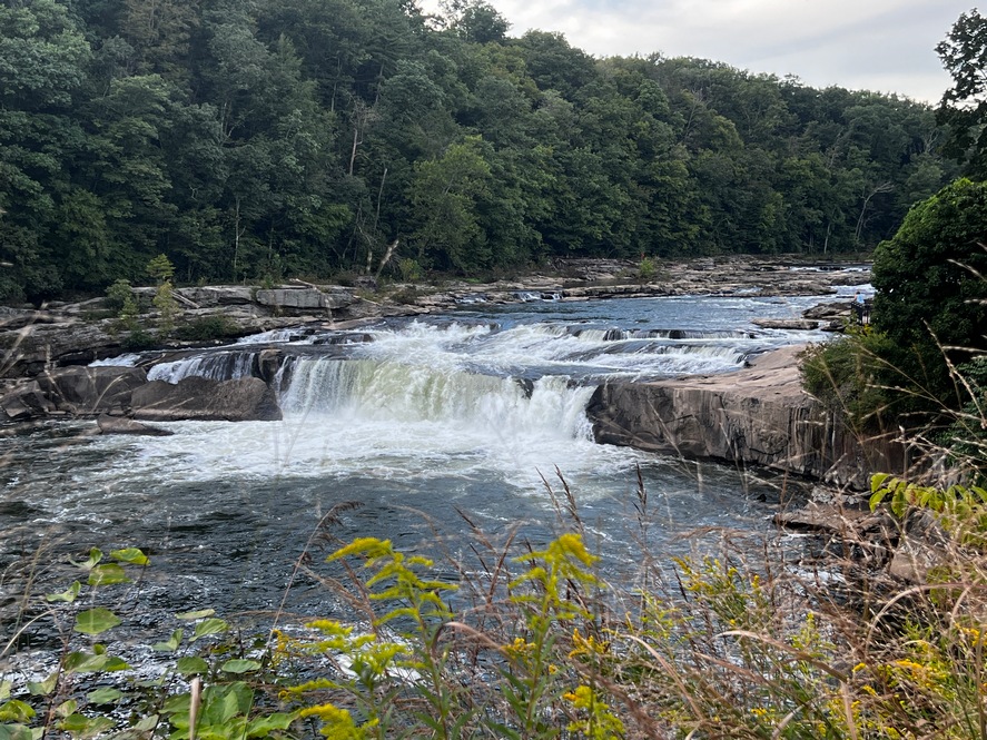
We crossed two long bridges over the Youghiogheny to arrive in Ohiopyle. This town was the epicenter of the GAP trail project. The first 27-mile section began here and ended in Confluence, entirely within the confines of Ohiopyle State Park. There are scenic falls, noted for having convinced George Washington (back in the 1750s) that this river was not navigable. (Actually, beyond the falls there are no obstacles.)


Sept. 12:
Our third day’s travel took us over bridges, through tunnels (real and leafy ones), following a new stream, the Casselman River. Rockwood turned out to be a disappointing stopping place for lunch, but we met some fellow trail riders, including a senior woman (80s?) riding her dream bike: a pink number, not electric. She told us a bit about her life’s adventurous days of backpacking and such.


Just prior to reaching our destination of Meyersdale, we began passing farms near the trail. Trailside is the Meyer family cemetery and a plaque telling the stories of those buried there. Many were about children and the diseases they suffered.
Then we rode the astonishing Salisbury viaduct, crossing far above cornfields and a freeway. We stayed at the Inn on Main, a lovely B & B just yards from the trail. The White House Restaurant in town was the place to go—they even offered a free shuttle service. That was handy as it started raining a bit that evening. They had a soup & bread bar (French onion). My dinner was filet tips and The Putterer had haddock stuffed with crab imperial.


From my trip journal: “The trail can be a bit monotonous, though it is quite beautiful. It’s an old railbed, of course, so it is flat and curves are subtle, not sudden. Also no abrupt changes in elevation, just a gentle grade. It allows the mind to wander.” And mine certainly did!
I enjoyed learning some eastern plants along the route:


Sept. 13:
Still a bit drizzly and foggy to begin our day, but gradually grew sunnier. We started out crossing a historic iron bridge, then a 900-foot-long viaduct and began a steady climb to the Eastern Continental Divide. (Living by “The” Continental Divide through the Rockies, I had not really thought of an eastern one!)


About one mile further, we reached the longest tunnel we would traverse. The Big Savage tunnel is 3,294 feet long. The path covers the entire width, and it is well lit (which my next post will contrast with another long tunnel on the C & O). Just beyond the tunnel, we crossed the Mason-Dixon Line where there are stone markers and signs.


We stopped in Frostburg and visited the Thrasher Carriage Museum, dedicated to all horse-drawn conveyances. Most are in pristine condition and one was of note, historically: the carriage that Teddy Roosevelt rode in for his first inauguration. We wandered through on our own, but a docent was giving a tour to another group and his booming voice could be heard through the entire building.


From Frostburg to Cumberland, the trail runs alongside the Western Maryland Scenic Railroad. It also drops about 1,200 feet, so it’s a gentle glide. I had just put my phone away when the train came roaring up the hill and I missed my photo op.
We arrived in Cumberland mid-afternoon and wandered through the C & O Canal Museum before heading to our hotel for the night. The next day we would begin our journey on the canal towpath.


To Be Continued…
Feature image: Falls of the Youghiogheny River at Ohiopyle, Pennsylvania.


What a fascinating trip! Looking forward to hearing more about it.
LikeLiked by 1 person
Thanks, Marie!
LikeLiked by 1 person
awesome pictures
LikeLiked by 1 person
Thanks, LA!
LikeLiked by 1 person
You just have the best adventures Eilene! My butt and probably my hips would have protested loudly after about 5 miles 🙂
LikeLiked by 1 person
I like seeing the world at bicycle pace. This was a good time, for sure. We got lucky with the weather and never used our rain gear.
LikeLike
This sounds like an amazing experience. I used to love biking, and there is a long rail trail here on the Cape. But we gave up our bikes this year after too many people we know were injured. Be careful and enjoy!!
LikeLike