By Eilene Lyon
Many Cumberland restaurants are closed on Sundays, but we found a place to get a burger that even had some live music out on the sidewalk. I took a stroll along the Potomac River later in the evening. A gaggle of Canada geese grazed on the grass near the towpath.
Across the river was West Virginia, which would be the case for most of our time on the C&O towpath. In the river I spied a great blue heron and a great egret. The heron got testy about the egret and drove her off, then took her place on the vacated log. I also noted the Footer’s Dye Works building near our hotel. It was once a huge operation in Cumberland covering several blocks, but only this one building remains.


Sept. 14:
Our destination for the day was called Little Orleans. If there is an actual town, we did not see it. The only “town” along the way is Oldtown, and the only restaurant there is closed on Mondays. We knew this in advance and packed food and extra water. There are campsites all along the route with porta-potties and water pumps, but the water is not potable.
We’d been told to expect the towpath to be mostly dirt two-track, rutted, with tree roots, and possibly muddy. However the route has been upgraded most of the way to be much like the GAP trail: hardpacked with a fine gravel surface. The only part that was “as advertised” was the Paw Paw Tunnel and a few miles beyond, where we encountered the trail construction crew working to improve this portion.
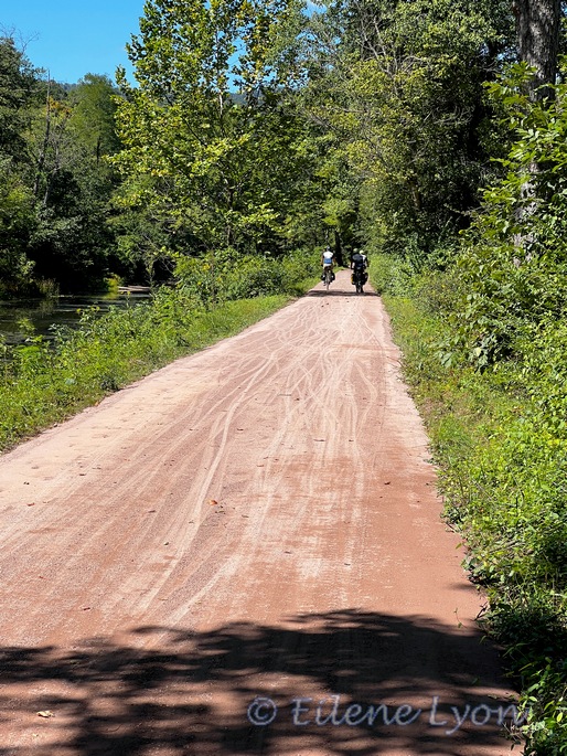
The route is entirely flat and does not have the bridges and viaducts like the GAP trail. We’d be passing 75 locks along the canal, most with a lock-keeper’s house nearby, in varying states of repair—a couple are available for lodging near DC.
The condition of the canal itself varies. Sometimes it’s just a depression filled with grass, trees, or weedy vegetation. It’s amazing to think all these giant tulip poplars and sycamores grew up in just the last 100 years. (The canal closed permanently in 1924.)
Other parts are filled with stagnant water, covered with pond weed. In a few places, the water is deeper and clear-ish, sometimes with water lilies. We spotted wood ducks (first time I’ve seen them) and turtles (many covered with pond weed). There were frequent deer sightings. Once we spied a giant snapping turtle swimming along.


Where the canal crossed over a drainage, an aqueduct went over the stream. There are also the remains of special guard locks that could be used to bring in water from the Potomac to fill the canal, or allow boats to move between canal and river.
The big excitement for the day was the Paw Paw Tunnel. Unlike the Big Savage Tunnel on the GAP, this tunnel is not lit for its 3,118-ft length (950 m). The canal takes up most of the space and there is just a narrow dirt path with a wooden fence to keep you from tumbling into it. They recommend you walk, but that’s more than half a mile to push a heavy ebike.
There didn’t appear to be anyone in the tunnel, so we rode nearly the entire length, which was bumpy with occasional puddles. The bike headlights showed only a short distance ahead—it was damn dark in there! We came up on three guys walking their bikes near the far end and had to dismount then.


At Little Orleans, we waited for a shuttle to take us to the Town Hill B & B, which is seven miles uphill from the trail. The shuttle stopped at a convenience store and grill so we could order carryout dinners.
The B & B was built in 1916 as a travel lodge for automobile tourists along the National Road. It was run down and closed for business when the current owners, Lisa and Roger, bought it and restored it to its former glory. The breakfast buffet the next morning was the most amazing B & B fare I’ve ever had.


Sept. 15:
Given that the towpath was seven miles away, mostly downhill, and on a road with little traffic, The Putterer and I opted to ride down. Everyone else took the shuttle—their loss! We had the option of taking the paved Western Maryland Rail Trail for the next 25 miles, which runs parallel to the C&O, but I think we made the right choice by staying on the canal path.


We did have to take a couple detours that day. One involved getting the ebikes up two sets of stairs using a steep ramp—not fun. At Hancock, we rode through town to the Blue Goose Bakery and Emporium for a cup of coffee and pastries. Back on the trail we saw more deer and a gobble of turkeys.
In the afternoon, we made a very short detour to see Fort Frederick, a stone military fort first erected on the frontier during the French & Indian War. I was fascinated to learn that what is now a state park was owned in the late 19th century by a former slave.


We ended our day in Williamsport where we stayed at Bay Farms B & B, which is downtown, not on a farm as suggested by the name. Walking around town after an Italian dinner at Tony’s, we heard and saw chimney swifts above the buildings—a bird we don’t see out west. Very cool.
Sept. 16:
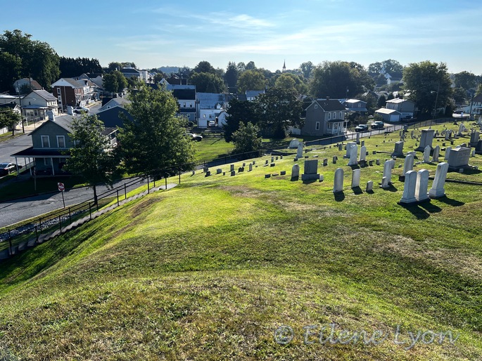
Breakfast was self-serve and we enjoyed some conversation with other trail riders before heading out. We stopped briefly at the nearby historic cemetery on a hill used by Maj. Abner Doubleday during the Civil War. Two historic signs disagreed on his connection to the invention of baseball.
We passed many Civil War-related sites as the day progressed. Nearing Sharpsburg, we opted not to visit the Antietam Battlefield site. We made a stop at McMahon’s Mill and learned that the next section of trail would be on the river itself. This area of dammed slackwater served in place of the canal, because of the cliffs adjacent to the Potomac. This most-expensively engineered project in National Park history was built in 2012.
Afterward we headed across the river to Shepherdstown, West Virginia, a lovely college town where we had lunch. From then on, the Potomac got wider and shallower, showing a lot of bedrock and small, wooded islands. We continued on to Harpers Ferry. I’ll cover our stop there in my next post.


Sept. 18:
Our final day of riding was also the longest at 54 miles (we skipped six miles). A notable site on this section was the Great Falls Tavern (which is not a restaurant as I had assumed) at the falls of the Potomac at Mile 22. This final leg of trail had the worst conditions since Paw Paw Tunnel. You’d think being so close to Washington it would be in the best shape, but no!


The last ten miles were particularly bumpy and once in the city, muddled by construction. I tried calling the local shop where we would leave the ebikes, but the person on the phone was unhelpful. We used Google Maps to find our way instead. We had to detour around Trump’s closure of the Ellipse, but fortunately the city has good bike lanes, so we made it safely to our destination. I’ll cover our visit to Washington D.C. in my final post of this series.
To Be Continued…
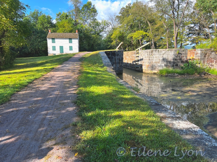
Feature image: The first lock and lock-keeper house on our C&O ride, typical of most.


I’m liking this portion of the trip a lot Eilene! The scenery and the history are definitely outstanding 🙂
LikeLike
I am having so much fun biking along with you—without having to do any pedaling!
LikeLike